
Hiking Prescott - Seven Mile Gulch Trail
I don't know about you, but when I hear the word "gulch" I think of things like ditches, gullies, and dry creek beds. Apparently whoever named the Seven Mile Gulch trail is not familiar with that common (and actual) definition of gulch because this trail pretty much just goes up a mountain. Also, the trail is 3.1 miles one-way. (apparently the trail "follows" the gulch). All sorts of confusion going on here.
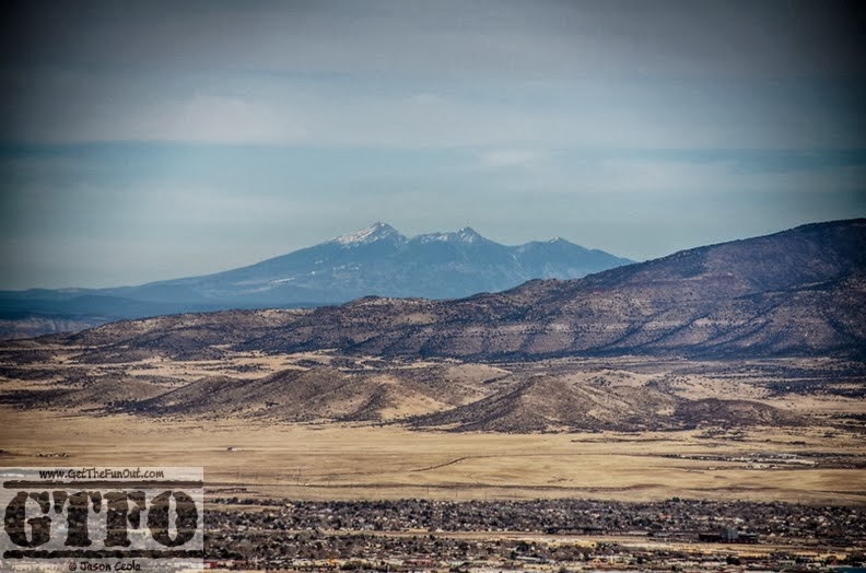
Furthermore, the Prescott National Forest website's description that "There are panoramic views of the San Francisco Peaks to the north, Prescott Valley to the northeast, Lynx Lake and Lynx Creek drainage to the east, and Spruce Mountain to the south" is ever-so-slightly misleading. That information is literally correct, but when I read about views like that it leaves me expecting unimpeded and awe-inspiring views from the end of the trial...usually that's the point of hiking to the end. So while these views exist, the best views of most sights come in the first 1/3 of the hike. From the top you have to peer through and around pine trees and must go off trail for the least-impeded views.
 |
| Ok, this is the view! |
The National Forest website has accurate directions to the trailhead. (approx. 2 miles down Walker Rd from Rt. 69). There are a few parking areas around the 2 mile mark, so don't park until you see the sign for Seven Mile Gulch. At least two trails leave from the parking area. Walk away from the road to get to the Gulch Trail. After that the trail is generally easy to follow, but there is one possibly confusing area about .25 miles in: a sign will point you to the right to stay on the trial and when you round the bend there is an unauthorized trail to the hard right going up a hill; a trail and possible camping area to the left--neither of those are the trail. Keep going basically straight with a bend to the right for the Gulch Trail.
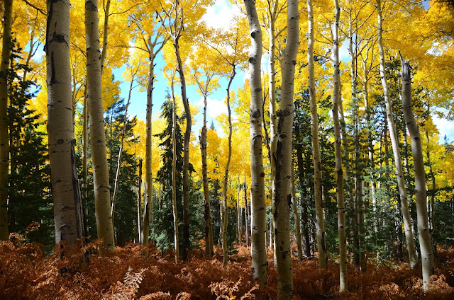
The first .5 miles or so meanders easily through wooded areas, possibly leaving you wondering what the big deal is. Well, after that you're going to be going up pretty often on a fairly unshaded and rocky trail, so be prepared. I hiked on a warm January day with high temps in the 50s. I wore shorts and a tank top, and still was drenched in sweat. Small pine and juniper trees provided a brief spot of shade about every 200-400 yards, but don't count on this for comfort in warmer months. Other than the interspersed trees, the trail is completely unsheltered and you are exposed a majority of the time.
 The trail itself is one of the more rugged I have hiked. It doesn't require any real technical expertise, but it does demand a great deal of attention as a significant portion has golfball to softball sized rocks underfoot. One must take caution not to twist an ankle, lose their footing, or tramp about on protruding rocks. I recommend wearing hiking boots simply for foot protection. I wore Nike trail running shoes (as usual) for this hike and most of the return trip was spent in discomfort due to the knobby footing. Unless you run marathons barefoot or are simply determined to be obstinate you should leave the Five-Fingers, Minimus's, Chacos, etc. behind in favor of sturdy footwear.
The rocky trail bedding also requires extra care on the return hike, lest you find yourself suddenly examining the trail from a seated position. Watch where you step, but also break often to take a look around because the view is best going down.
All-in-all, this is a nice hike that is definitely a challenge but is a great getaway.


.jpg)